In this article, we are taking a look into the best drones for crop scouting.
What are UAVs?
UAVs, or Unmanned Aerial Vehicles, are aircrafts that operate without a human pilot onboard. In general, UAVs are a component of a broader category known as Unmanned Aircraft Systems (UAS), which include the UAV itself, the ground-based controller, and a system of communications between the two.
As a rule of thumb, know that the terms -UAVs and Drones, can be used interchangeably.
Let’s just say, what we decide to call it really depends on how they are marketed.
It is a common practice to market UAVs as drones to the end consumer. .
Drones for Precision Farming
According to a blog posted by IBM, Smart Farming is –
Quoteblock: the adoption of advanced technologies and data-driven farm operations to optimize and improve sustainability in agricultural production. Technologies used for smart farming include artificial intelligence (AI), automation and the Internet of Things (IoT).
Such applications of drones in agriculture can be broadly referred to as “Precision or Smart Agriculture.” And the underlying technology used is called AgTech.
The application of drones in agriculture has revolutionized the farming landscape. One such application of Drones in agriculture is for crop surveillance.
Crop Surveillance might appear to be a small part of a farmer’s everyday to-do list, but in reality, it has great implications for the final harvest.
Best Drones for Crop Scouting
Wondering, “What exactly is the best drone for crop scouting?” Look no further.
In this guide, you will learn about:
- The best Drone models for Drone Scouting.
- What should be the evaluation criteria for picking the right drone model?
So let’s start at the beginning and find out why the correct drone could provide numerous advantages for your farm operations.
Article Highlights:
- Top drones for crop scouting include the DJI Phantom 4 Pro, the SenseFly eBee X, & the Yuneec Typhoon H Pro
- Optimal Flight Time, mapping software, and high-resolution cameras are a few recommended pro trips for new pilots
- Agriculture is changing & drones are helping farmers run more efficient operations.
- Advanced Imaging Technology: Equipped with a 3-axis motorized gimbal and 1-inch 20MP CMOS sensor with a mechanical shutter for high-quality, distortion-free images.
- Enhanced Viewing and Control: Features a 5.5-inch 1080p LCD screen on the remote controller for clear visibility in direct sunlight.
- Superior Flight Performance: Boasts a maximum speed of 72 kph, 8km transmission range with 1080p livestreaming, and OcuSync 2.0 for efficient frequency switching.
What is Crop Scouting
Although the use of drones for Crop Scouting is fairly new, “Crop Scouting” has been, and will always be, an integral part of farming.
So what is crop scouting exactly?
In plain terms, it is the act of going around your farmland and checking up on your crops. Although it is thought to be an integral pest management strategy, Crop Scouting can help assess the overall health of your crops that include:
- Checking Water Stagnation
- Pest Control
- Detecting Abnormalities
- Assessing Crop Health
- Yield Estimation
- Field Mapping and Planning
- Evaluating Crop Damage
- Soil Condition Monitoring
Evolution of Drones in Agriculture
To understand the evolution of drones, we have to take a trip to 1980’s Japan.
Between 1983 and 1990, Yamaha built the R-50 industrial-use unmanned helicopter. It was the first of its kind, intended for agricultural spraying.
The initiative started from cooperation with the Agriculture, Forestry & Fishery Aviation Association. Yamaha moved to a single-rotor design despite early technical challenges, producing the popular R-50 model in 1987. This invention boosted agricultural interest and helped to reduce the labor-intensive pesticide application. With thousands of certified operators, unmanned helicopters had become somewhat popular in Japan by 2003.
The R-50 was also being used in golf courses to kill pests that harm the pine trees. With initial success, the R-50 was then commissioned to be used for spraying pesticides on crops of rice, barley, soybeans, lotus root, daikon radishes, chestnuts, and citrus fruits.
Fast forward to 2024, if you drive past any midwestern corn belt, and if you are lucky, you might catch a glimpse of drones flying over the fields. These drones are employed to capture leaf-level field imagery. Using the captured data points the farmers adjust their farm management strategies.
Nowadays, drones come in a variety of shapes, sizes, and capabilities, each model promising a more efficient way to monitor crops.
However, drone technology has come a long way. Nowadays, drones come in a variety of shapes, sizes, and capabilities, each model promising a more efficient way to monitor crops. With each year, we get to see advancements in terms of –
1. Frame
- Motors
- Propellers
- Sensors
- Control System
- Power System
- Communication System
- Payload
- LiDAR scanners
Types of Crop Scouting Drones
There are two primary types of crop-scouting drones:
- Quadcopter UAVs
- Fixed Wing UAVs
The table below includes essential details of quadcopter UAVs and Fixed Wing UAVs.
Criteria | Fixed Wing UAVs | Quadcopter UAVs |
Price Range (Estimate) | $10,000+ | $500 – $10,000 |
Frame | Resemble small airplanes | X or H |
Rotors | Single for multiple | 4 |
Flight Efficiency | Efficient for covering large areas | Ideal for short-range missions and tasks |
Endurance | Longer flight times | Limited by battery life |
Speed | Faster over longer distances | Quick maneuverability in confined spaces |
Payload Capacity | Greater payload capacity | Limited payload capacity |
Takeoff/Landing | Requires runway for takeoff and landing | Vertical takeoff and landing capabilities |
Stability in Wind | More stable in windy conditions | Susceptible to wind disturbances |
Cost of Operation | Generally lower operational costs | Higher operational costs |
There are so many UAV options, hence it can be difficult to figure out which kind of drone will fit your needs. Fixed-wing aircraft are great at covering large distances. They do not support frequent takeoffs. Also, it does not give you the ability to hover in the air or make swift turns. Furthermore, it doesn’t allow vertical landings and takeoffs. As the body resembles a miniature version of a commercial passenger aircraft, the fixed-wing aircraft needs to be placed on a runway for takeoff and landing.
On the other hand, the Quadcopters’ multirotor architecture permits hovering in the air, climbing and descending vertically, and executing precise maneuvers. One of their disadvantages is, they can cover shorter regions compared to Fixed-wing aircraft. However, if you want leaf-level field imagery, then these are the best options.
Legal and Operational Considerations for Crop Scouting with Drones
Depending on your country of residence, you will have to abide by different regulatory frameworks for drone usage. In the United States, Drone rules are enforced by the Federal Aviation Administration (FAA) under the Federal Aviation Regulations (FAR) Part 107.
Legal Requirements for Owning and Operating a UAV
Let’s grasp the legal obligations from two angles:
- Legal obligations for the Pilot.
- Legal regulations for the drone.
For the Pilot:
- To fly a drone for leisure, you have to successfully pass “The Recreational UAS Safety Test (TRUST),” and provide certification of completion.
- Commercial pilots have to hold a Remote Pilot Certificate (Part 107 license) from the Federal Aviation Authority (FAA).
- All drones over 0.55 pounds (250 grams) have to be registered with the FAA.
Rules that apply to the drone as per the FAA Part 107:
- Unless within 400 feet of a structure, fly at or below 400 feet.
- Keep your drone within eyesight by either you or an observer.
- Has to be less than 100 miles per hour.
- Avoid airports & maintain a significant distance with other aircraft.
- Not allowed to fly above individuals unless they personally participate in what is happening.
- Unless over a sparsely populated region, must not operate a drone from a moving vehicle.
- Unless the drone has anti-collision lights, fly only during daytime hours.
Operational Factors to Consider When Using a Drone for Crop Scouting
With an estimated worth of $4.17 billion in 2022 and an anticipated rise of $18.22 billion by 2030, the agricultural drone industry is experiencing rapid expansion and boasts a 20.3% compound annual growth rate (CAGR).
From boosting safety protocols to conducting field surveying, drones have discovered a wide range of uses on farmland of all sizes. Their data is more than simply statistics; it’s the foundation of “precision agriculture,” which helps farmers make intelligent decisions that may increase yields by as much as five percent (5%), which is a huge deal in an industry where profit margins are historically bleak.
The price per acre may vary considerably depending on a number of factors, but usually falls anywhere between $5 to $50 per acre. This amount is the sum of battery cost, and the fees charged by the service provider.
Flight Planning
Depending on the size of your farmland, you need to draft a suitable flight plan that is both effective and efficient. There can be many challenges posed by large fields, difficult terrains, and steep landscapes. You need to include all of these in your flight planning.
Weather Conditions
At the end of the day, Drones are built using intricate electrical components, which are susceptible to different weather conditions. These weather conditions include – high altitudes, humidity, low temperatures, and rain.
Battery Life
If you have a huge farmland, you are better off with a Fixed Wing UAV. They can cover large areas with one single flight. Due to their aerodynamic designs, these drones can withstand extreme weather conditions better.
Video Credit: DJI Agriculture
On the other hand, when it comes to Quadcopter UAVs or even Hexacopters UAVs, their ability to hover, quickly change directions, and fly at low altitudes makes them perfect for accurate applications and close examinations of crops.
As a rule of thumb, compared to Quadcopter or Hexacopters UAVs, Fixed Wing UAV require less-frequent battery recharge or battery replacements.
Drones vs. Other Aerial Imagery Sources
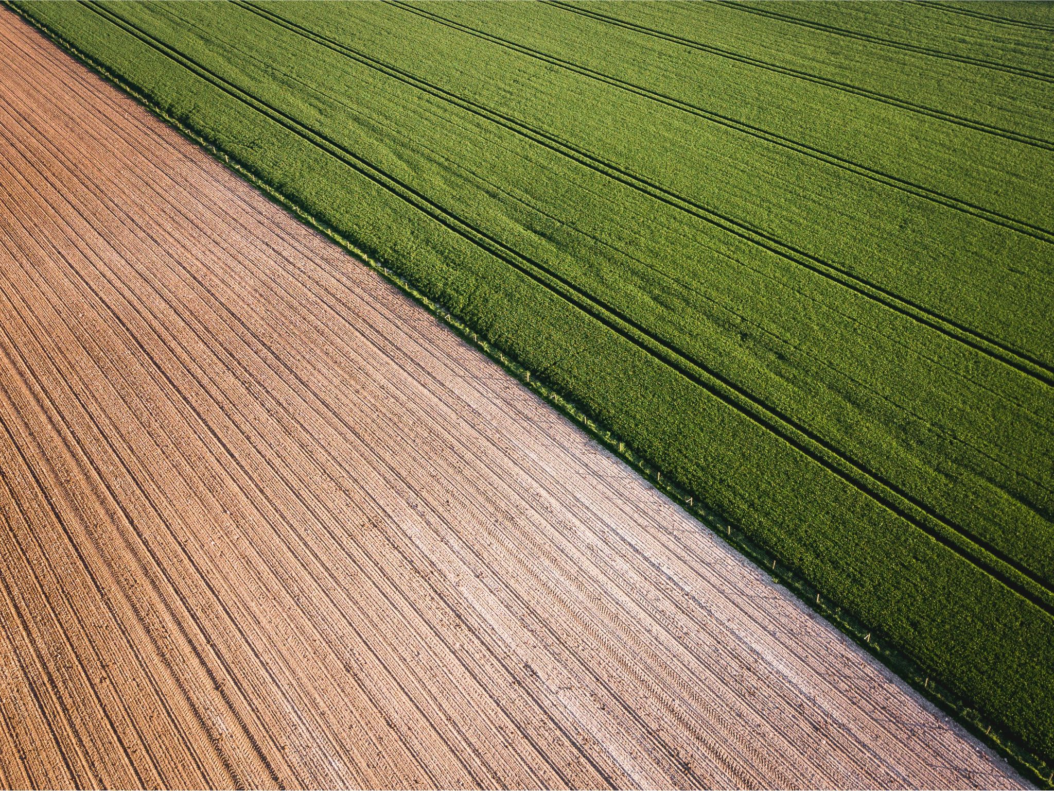
Aerial Imagery is essential for multiple things:
- Crop Monitoring
- Irrigation Management
- Soil Testing
- Estimating Yield
- Field Mapping
When it comes to aerial imagery, there are primarily three options.
- Drones
- Manned aircraft
- Satellites
Satellite | Manned aircraft | Drones | |
Captured by | electronic scanners in satellites | camera systems attached to airborne craft such as planes and helicopters | Cameras and sensors on unmanned aerial vehicles (drones) |
Types include | visible, infrared, water vapor | vertical and high and low oblique | RGB (visible spectrum), multispectral, thermal, LiDAR |
Best suited for | wide-scale scientific operations | commercial applications across various industries, from construction and real estate to insurance and urban planning | Precision applications that require targeted and up-to-date imagery |
Resolution | 30 cm is currently the highest commercially available resolution | 10-15 cm and can go up to as high as 2.5 cm depending on application. | Typically ranges from 1 cm to 10 cm, depending on the drone’s capabilities and flight altitude |
Advantages include | covers a wider area | higher detail and more accurate | Flexibility and real-time monitoring |
Choosing the Best Drone for Crop Scouting
Depending on your needs, we’ve outlined several key considerations and recommendations to help with selecting the ideal crop-scouting drone for your business.
Key Considerations When Choosing a Drone for Crop Scouting
- Purpose and Features: Be clear about your objective. Is your plan to do high-level investigations or more basic scouting? For broad scouting, the drone ought to capture high-resolution imagery; for detailed crop health evaluations, it should have multispectral sensors.
- Battery Life and Flight Time: Never forget to think about how long the drone is capable of flying on a single charge. Drones with longer flight times are required to cover greater areas during surveillance flights.
- Ease of Use: Different drones need different levels of technological expertise. Think about how simple it is to launch and set up the drone, as well as its control system and software compatibility.
- Durability and Repairability: How resistant is the drone to the kind of weather that you usually encounter where you live? How easy is it to fix, and where can you get fresh parts?
Recommendations for the Best Drones for Crop Scouting Based on Different Needs and Budgets
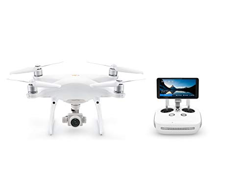
- Budget-Friendly: DJI Phantom 4 Pro – High-resolution imaging and an impressive flight time for smaller farms.
- Mid-Range: Parrot Bluegrass – Equipped with multispectral sensors, perfect for a more detailed crop analysis.
- High-End: SenseFly eBee X – Long endurance and top-notch sensors, perfect for large-scale, professional crop scouting.
Exploring Popular Drone Models Used in Crop Scouting
Drone Model | Features | Speed | Camera | Range | Flight Time | Price Range | Ideal For |
High-resolution imaging | 45 mph | 20 MP | 5 miles | 30 min | $1,500-$2,000 | Small to medium-sized farms | |
Multispectral and thermal imaging | 69 mph | 24 MP | 18.6 miles | 90 min | $10,000-$15,000 | Large scale professional crop scouting | |
HD camera | 35 mph | 12 MP | 1.2 miles | 25 min | $800-$1,200 | Beginners and small farms | |
High-performance camera | 58 mph | 24 MP | 4.3 miles | 27 min | $3,000-$5,000 | Professional filmmaking and aerial photography | |
360-degree gimbal | 43.5 mph | 12 MP | 1 mile | 25 min | $1,500-$2,000 | Advanced photography and videography | |
Heavy payload capacity | 35 mph | Varies with camera | Depends on controller | 20 min | $5,000-$7,000 | Heavy-duty commercial use | |
Thermal and visual light cameras | 40 mph | 16 MP | 3.1 miles | 30 min | $4,000-$6,000 | Thermal imaging tasks | |
Spray system for crop spraying | 22 mph | NA | 1 mile | 10 min | $15,000-$20,000 | Agricultural spraying |
How to Use a Drone for Crop Scouting
Step-by-Step Guide to Effectively Using a Drone for Crop Scouting
Like every other job, it is best to prepare an SOP (Standard Operating Procedure).
Step 1 – Flight Planning
Step 2 – Pre-Flight Check
Step 3 – Flight Execution
Step 4 – Data Collection
Step 5 – Data Analysis
Make a layout on the map with your farm marked out on it. To outline your property, you can use a GPS device.
You should always clean the lens, make sure the battery is charged, and inspect the rotor blades. As a backup, be sure you include additional fully charged batteries.
Tips and Tricks for Capturing and Analyzing Data
When it comes to capturing and analyzing your drone data, consider the following best practices:
- Day Time: Go for Crop Scouting during the day. The best time is during the early hours of dawn.
- Regular Flights: Make sure you conduct crop scouting in fixed intervals. This way you can properly track the progress.
Future of Drone Crop Scouting
Precision Farming is not a new concept. With each passing day, more and more people are adopting Ag-tech, and drones are definitely at the forefront of it.
Currently, new drones are coming into the market that can capture the light of different wave lengths. Thanks to this feature, farmers can get early alerts about pest infestation, crop stress, and other key parameters that go just unnoticed by the naked eye.
Final Thoughts
The use of unmanned aerial vehicles (drones) for agricultural scouting entails tracking and evaluating the state of crops. Drones fitted with an array of sensors may take comprehensive images and collect data, which aids in the early detection of issues including insect infestations, nutrient shortages, water stress, as well as diseases.
Drone-assisted crop scouting can boost yield as much as 10%. More effective and environmentally friendly agricultural methods will be the end result of drone-assisted crop surveying.
FAQs
What is the best drone for crop scouting?
When it comes to the Best drones for crop scouting, DJI Phantom 4 Pro V2.0 and the SenseFly eBee X, are popular choices.
How are drones used in crop scouting?
Drones help with Crop Monitoring, Irrigation Management, Soil Testing, Estimating Yield, and Field Mapping.
What are the advantages of using drones for crop scouting?
Drones offer accuracy, efficiency, and cost-effectiveness for crop scouting. Drones can cover vast regions in less time and capture high-quality images.
What are the legal and operational considerations when using a drone for crop scouting?
For commercial Drone use, you will need to – obtain a Remote Pilot Certificate, fly at or below 400 feet, keep your drone within sight of you or an observer, and not exceed the speed of 100 miles per hour.
What is the future of drone crop scouting?
The future seems promising for crop scouting using drones. With every day, new technologies are being incorporated into Drones. Even the most modest ones offer infrared imaging, and Lidar.