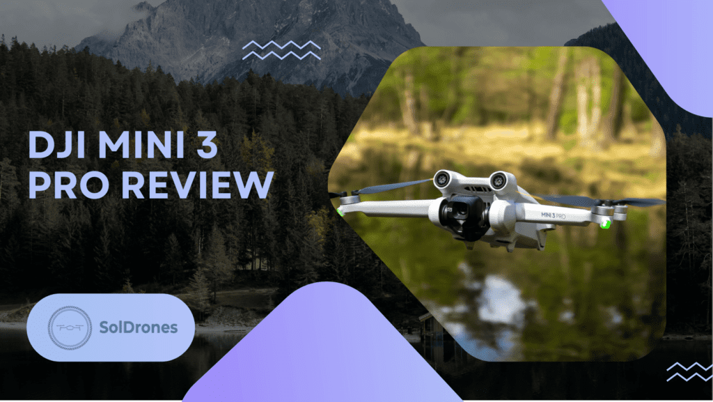
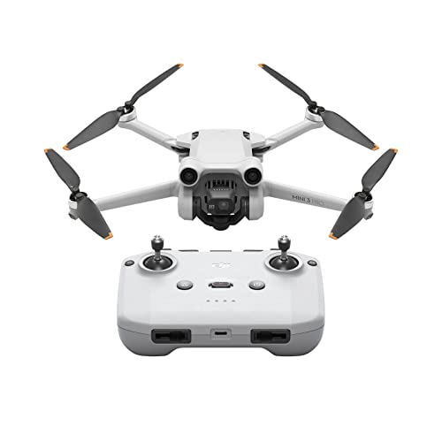
- Compact and Lightweight: Weighs less than 249 g and folds for easy portability.
- High-Quality Imaging: Captures 4K/60fps video and 48MP photos, with advanced low-light capabilities.
- Enhanced Flight Time and Safety: Offers up to 34 minutes of flight, extendable to 47 minutes, and features tri-directional obstacle sensing for safer flying.
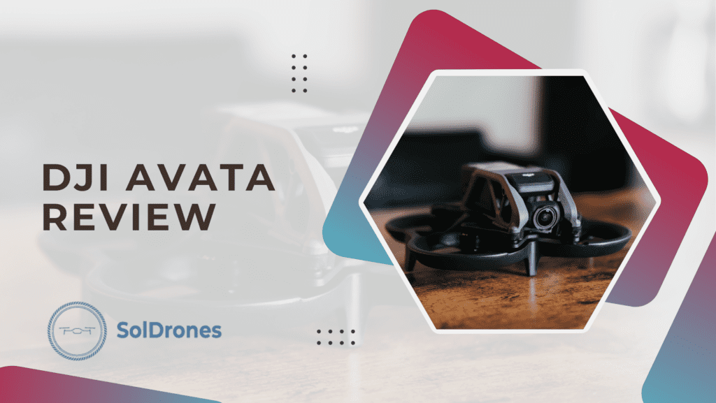
Video Credit: Joshua Bardwell
How GPS Powers Drone Navigation
Central to the autonomous capabilities of drones is the fundamental GPS system. GPS serves as the linchpin that facilitates precise and autonomous drone journeys.
It’s not just about charting courses. GPS technology is what elevates drone capabilities.
By tapping into GPS signals, drones achieve an advanced spatial understanding, allowing them to navigate their surroundings with unparalleled precision.
This intelligence extends beyond accurate tracking. It also empowers drones with the crucial ability to avoid obstacles. The ability of drones to interpret signals in real time allows them to maneuver through complex airspace effortlessly and avoid hazards without any difficulty.
This integration transforms drones into dynamic tools, ensuring not only pinpoint accuracy but also expert navigation through dynamic and challenging environments.
Components of a Drone GPS System
Unlocking the mechanics of drone navigation involves exploring all the components that collaborate to ensure a drone’s precise and autonomous journey. Here are the following:
- GPS Receiver: This part connects to satellites, telling the drone exactly where it is.
- Inertial Measurement Unit (IMU): It keeps the drone stable by tracking how it moves.
- Flight Remote Control: Think of it as the brain – a remote controller processes information and guides the drone’s flight.
- Radio Transmitter: This allows the drone to talk to the operator, making communication smooth.
- Antenna: Like a drone’s communication hub, it helps exchange signals for better responsiveness.
- GPS modules: They allow the drone to calculate its exact geographical coordinates.
- Carrying case: It is designed to safeguard the drone from physical damage, dust, and moisture during transportation and storage.
Moreover, modern drone GPS systems often come equipped with additional user-friendly features such as smartphone connectivity and headless mode.
The inclusion of these elements extends the accessibility and ease of control for both novice and experienced drone enthusiasts.
With a drone GPS system boasting these components, users can confidently navigate their drones, enjoying a seamless flying experience.
Benefits and Applications of Drone GPS Systems
Unlocking a realm of possibilities, drone GPS systems play an important role in enhancing unmanned aerial capabilities.
Advantages:
- Surveying: Drones, armed with GPS precision, redefine surveying, ensuring accurate mapping and efficient data collection.
- Mapping: The seamless integration of GPS technology empowers drones to create highly detailed maps, benefiting industries like urban planning and environmental monitoring.
- Package Delivery: Picture a future where packages find their way directly to your doorstep, facilitated by the pinpoint accuracy of drone GPS systems.
Real-world Application:
From assessing agricultural crop health with unmatched precision to navigating complex urban landscapes for surveillance purposes, these real-world scenarios showcase the transformative impact of GPS systems.
In essence, drone GPS technology emerges as an indispensable tool across a multitude of industries, reshaping the landscape of modern applications.
Challenges in Drone GPS Systems
While drone GPS systems offer unparalleled advantages, they are not without their challenges.
One significant hurdle is the susceptibility to signal interference, especially in urban environments with towering structures. This interference can compromise the precision of location data, potentially leading to navigational errors.
Additionally, adverse weather conditions, such as heavy rain or snow, can further impede the effectiveness of GPS signals.
Despite these challenges, ongoing developments in the field strive to enhance the resilience of drone GPS systems.
Advanced signal processing techniques and the integration of alternative navigation methods, such as computer vision, are emerging as promising solutions.
These innovations aim to fortify drone navigation, ensuring reliability even in challenging scenarios.
As technology evolves, addressing these challenges becomes pivotal for unlocking the full potential of drone GPS systems.
Best Affordable Drones with GPS
An affordable quadcopter equipped with GPS technology brings the advantages of precise navigation within budgetary constraints. Here’s a list of budget-friendly drones that combine affordability with advanced GPS features:
- DJI Mini 3 Pro
- Lightweight and foldable design
- 4K/60fps video and 48MP photo capabilities
- 34-min flight time
- Tri-directional obstacle sensing
- DJI Mavic Air 2
- 48MP camera, 4K video, and 8K hyperlapse
- 3-axis gimbal, 34-min flight time
- Active Track 3.0 and Ocusync 2.0
- Gray color for a sleek appearance
- DJI Mavic Pro
- Compact design with OcuSync transmission technology
- 4.3mi range and Full HD 1080p live video streaming
- 27-min flight time
- 4K video resolution
- SwellPRO Spry+ Plus
- Water-resistant for aquatic adventures
- Compact and lightweight
- Suitable for beginners

- Waterproof Design: Features an IP67 seawater-proof body and IP66 waterproof remote controller, ideal for marine environments.
- High-Quality Camera: Includes Swellpro GC3-S Waterproof 3-Axis Gimbal 4K Camera for clear, stable aerial footage.
- Extended Transmission Range: Offers up to 5km image transmission, enhancing remote piloting capabilities.
- Advanced Safety Features: Equipped with automatic power flip for added safety and control during operations.
These drones offer a blend of performance and affordability, making them ideal choices for both beginners and enthusiasts looking to explore GPS capabilities without breaking the bank.
Choosing the Right Drone Tracker
Selecting an appropriate drone tracker is important in locating your drone, complying with registration rules, and enhancing flight safety.
![]()
When choosing a drone tracker, consider key features such as accuracy, compatibility with your drone model, extended battery life, user-friendly interfaces, and durable construction.
These aspects collectively contribute to a reliable tracking system that safeguards your investment and aligns with aviation regulations. Prioritize these features so you can make an informed decision and fly your GPS drone without any worries.
Comparing GPS and RF Trackers
When deciding on a drone tracker, understanding the distinctions between GPS and Radio Frequency (RF) options is crucial.
GPS trackers rely on satellite signals, offering high accuracy and worldwide coverage. They excel in real-time tracking but might face limitations in urban environments or indoors.
On the other hand, RF trackers use radio signals and provide an independent solution unaffected by satellite or GPS obstructions. While they offer reliable performance, the range is shorter compared to GPS.
Consider your specific needs and surroundings when choosing between GPS and RF trackers to ensure an optimal tracking solution for your drone.
Final Thoughts
A drone’s GPS system is the linchpin for precise navigation, with key components like GPS receivers, compasses, and barometers ensuring accuracy.
The integration of GPS empowers drones with autonomous capabilities, enabling obstacle avoidance and reliable tracking.
Understanding the components, benefits, and challenges of drone GPS systems is also important for both beginners and experienced users.
Moreover, affordable drones with GPS and the right drone tracker enhance the overall drone-flying experience.
Finally, by comparing GPS and RF trackers, users can make informed decisions based on their specific needs.
Embracing this technology opens doors to diverse applications, from mapping to package delivery, showcasing the versatility and potential of drone GPS systems.
FAQs
What is the role of GPS in drone navigation?
GPS in drones serves as a crucial component for providing accurate location data, enabling autonomous flight, obstacle avoidance, and precise tracking.
What are the key components of a drone GPS system?
A drone’s GPS system consists of essential components like GPS receivers, compasses, and barometers, working together to ensure precise navigation.
How does GPS contribute to the benefits of drone technology?
GPS enhances drone technology by offering advantages such as autonomous flight, accurate navigation for applications like surveying and mapping, and real-world utility in scenarios like package delivery.
What challenges are associated with drone GPS systems?
Challenges in drone GPS systems include vulnerabilities like signal interference and the need for continuous developments to overcome obstacles, ensuring optimal functionality.
What features should be considered when choosing a drone tracker?
When selecting a drone tracker, it’s crucial to consider features like accuracy, compatibility, battery life, ease of use, and durability to prevent loss, comply with regulations, and enhance safety during drone flights.