In an age where digital technologies dominate, drone thermal cameras have made their mark in drone thermography, standing out as a game-changer. It’s not just a trend; it’s revolutionizing industries from construction to agriculture through thermal drone technology.
Picture this: a building inspector, traditionally reliant on scaffolding and cranes, now accesses hard-to-reach spots with drones equipped with thermal sensors. Within moments, aerial thermal imaging pinpoints temperature disparities in structures, potentially indicating damage or inefficiencies.
Such precision isn’t a luxury—it’s a necessity. By harnessing the capabilities of thermography drones, professionals can save time, reduce risks, and optimize tasks. But what does it take to harness this technology truly? This article promises to unwrap the intricate layers of the drone thermography world, ensuring you’re well-equipped to navigate its vast landscape.
Article Highlights:
- Drone thermography revolutionizes building, wildlife monitoring, and search and rescue by detecting temperature disparities in structures.
- Drone mapping and thermography are pioneering airborne surveillance by producing in-depth heat maps for agriculture and energy.
- Drone thermography certification boosts professional reputation, opening doors to prospective careers and demonstrating technological expertise.
The Science Behind Drone Thermography
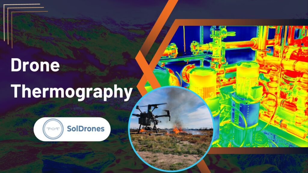
At its core, drone thermography is more than just aerial photography; it’s a blend of science and technology that delves deep into the unseen light spectrum.
By harnessing the capabilities of thermography drones, professionals can save time, reduce risks, and optimize tasks.
Standard Cameras:
- Capture images using visible light.
- Rely on colors that the human eye perceives naturally.
- Produce pictures that represent our day-to-day visual experience.
Infrared (Thermal) Cameras:
- Detect infrared radiation, typically emitted as heat from objects.
- Produce images based on temperature variations.
- Visualize patterns that are invisible to the naked eye, offering insights like heat loss in buildings or locating a missing person in dense fog.
By understanding the nuances between these cameras, professionals can select the best tool for the task, ensuring accuracy and efficiency in their respective fields.
Top Drones for Thermograph
In the rapidly evolving world of drone technology, thermography has found its champions in certain standout models. These drones are equipped with cutting-edge thermal cameras and designed for reliability, precision, and ease of use. Here’s a quick snapshot:
- Autel Robotics EVO II Dual FLIR Bundle: Designed for portability with an 8K camera and Dual 640 FLIR infrared sensor.
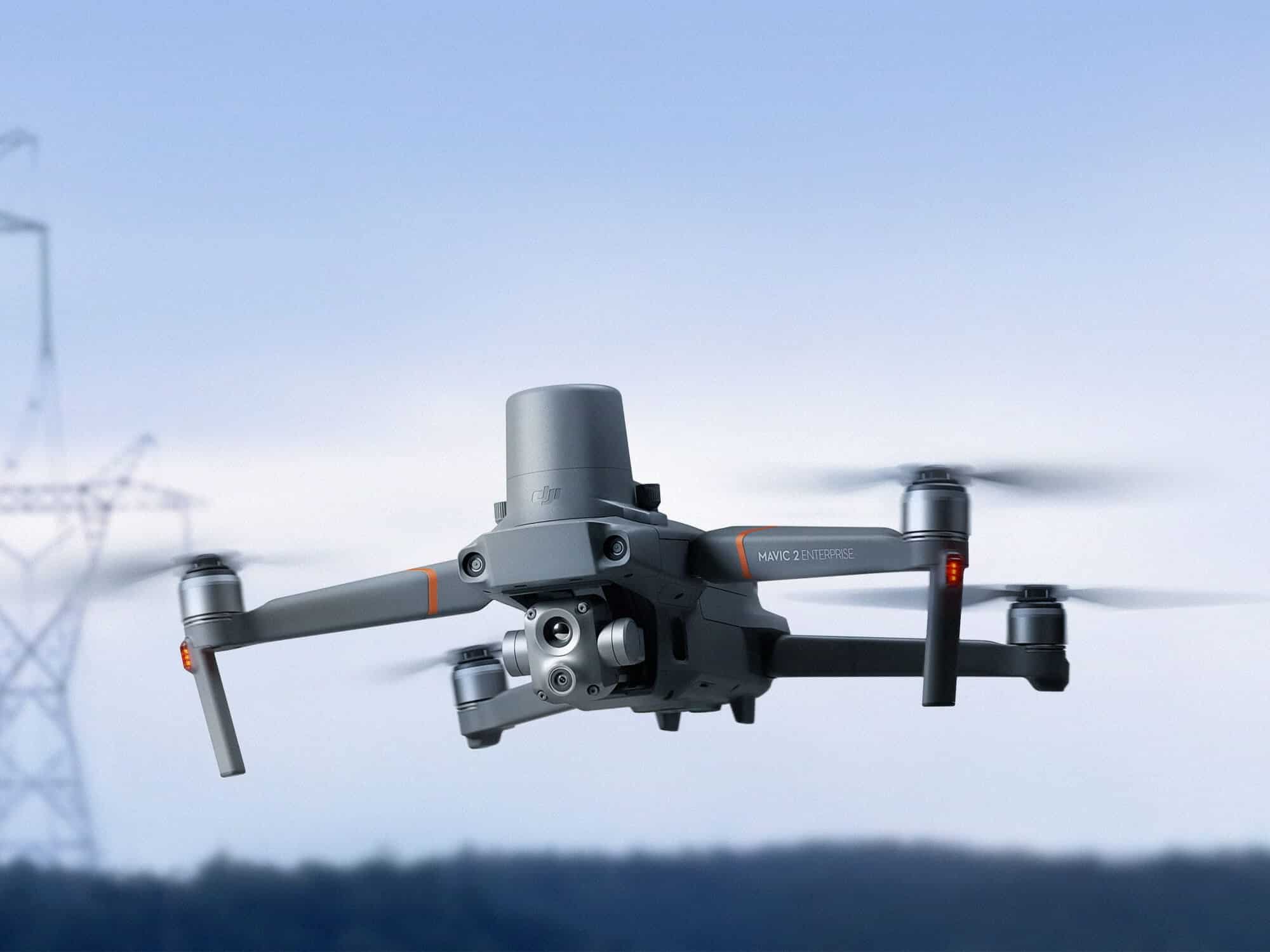
- DJI Mavic 2 Enterprise Advanced: Features a 640p infrared camera complemented by a high-resolution 48MP camera for detailed imaging.
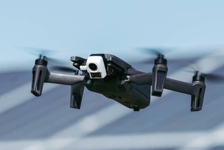
- Parrot Anafi Thermal Drone 4K: An ultra-compact drone that boasts of a 4K HDR camera and a FLIR radiometric thermal camera.
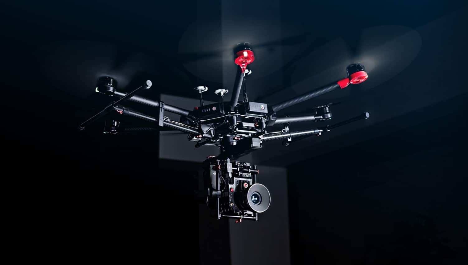
- DJI Matrice 600 Pro Hexacopter: A modular drone design compatible with the FLIR Vue Pro R Thermal Imaging Cameras.
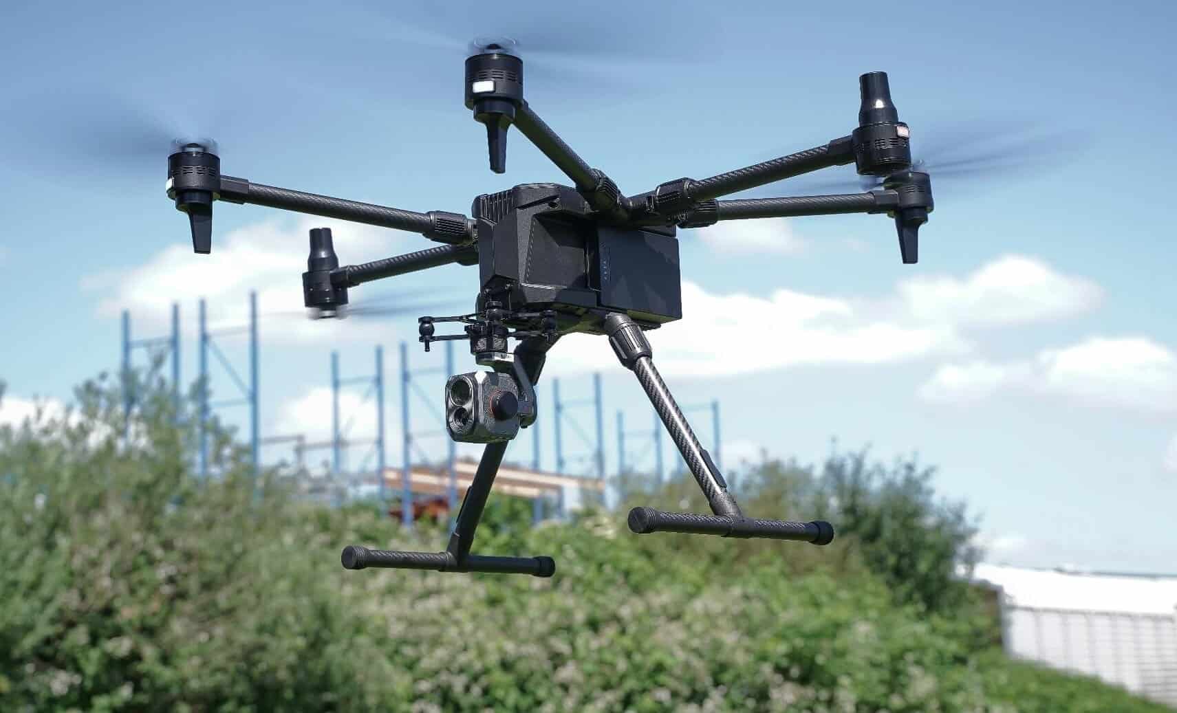
- Yuneec Unmanned Hexacopter System: Tailored for the inspection industry, this hexacopter pairs seamlessly with the E10T Thermal Imaging Camera.
Equipped with the right drone, professionals can harness the power of thermography to its fullest, revolutionizing sectors from construction to search and rescue.
Factors to Consider When Purchasing a Thermography Drone
When you’re in the market for a thermography drone, it’s not just about picking the one with the shiniest exterior. There’s a myriad of technical and functional aspects that can greatly influence your drone operations. Here are the critical elements to keep in mind:
- Hardware Considerations:
- Camera Resolution: Determines the clarity and quality of a thermal image.
- Battery Life: Crucial for determining how long you can keep the drone in the air.
- Obstacle Avoidance: Essential for safe and hassle-free flying, especially in complex terrains.
- Software and App Integration: Ensure the drone pairs seamlessly with intuitive software or apps that enhance user experience and data analysis.
- Potential for Upgrades and Accessory Compatibility: A future-proof drone compatible with newer accessories is a wise investment, providing longevity and adaptability.
Pondering these factors diligently will ensure that your investment meets and exceeds expectations in delivering impeccable thermographic insights.
Advancements in Aerial Thermal Imaging
The rapid growth of drone technology hasn’t been confined to just capturing breathtaking aerial visuals; it has also revolutionized the field of thermal imaging. Aerial thermal imaging has transcended boundaries and made significant inroads into numerous sectors.
- Construction: Drone thermography can swiftly detect building heat losses, pinpoint insulation defects, and uncover water leaks.
- Wildlife: Researchers are now harnessing the power of thermal imaging drones to monitor wildlife without causing any disturbance, especially during nocturnal hours.
- Search and Rescue: In conditions where visibility is poor, be it due to darkness, fog, or smoke, aerial thermography plays a crucial role in locating lost or trapped individuals.
The capabilities of aerial thermography drones are vast. They enhance efficiency and offer safety advantages, especially in challenging environments. As we venture deeper into the age of technology, it’s undeniable that aerial thermal imaging, with its myriad benefits, will continue to reshape industries and redefine possibilities.
Getting Certified in Drone Thermography
Obtaining a drone thermography certification is paramount in an industry that hinges on precision and trustworthiness. Not only does it serve as a testament to your skillset, but it also elevates your professional stature. Let’s break it down:
- Importance of Certification: Beyond just mastering the technical nuances, certification instills confidence in clients and potential employers about your expertise in the field. It’s an affirmation that you’ve been trained to harness the power of drone thermography effectively and safely.
- Process of Obtaining Certification: Typically, the journey involves comprehensive training sessions, hands-on flight experiences, and an examination that tests both practical and theoretical knowledge. Reputable institutions offer courses tailored to provide in-depth understanding and hands-on training.
- Enhancing Credibility and Opportunities: A certification isn’t merely a paper accolade. It’s a significant differentiator in the market. Certified drone thermographers often find themselves at an advantage, gaining access to premier job opportunities and forging trust-filled client relationships.
Armed with a certification, you’re showcasing your skills and underlining your commitment to the highest standards of professionalism in the dynamic world of drone thermography.
Drone Thermography Salary and Career Opportunities
In the ever-evolving landscape of technology, drone thermography emerges as a lucrative and sought-after specialization. While the earning potential can vary, on average, a drone thermographer can command a salary that significantly surpasses traditional drone piloting roles. Several factors come into play when determining this remuneration, including geographical location, level of certification, and years of experience in the field.
Moreover, the diversification of industries leveraging drone thermography provides an expansive playground for career opportunities. From construction sites monitoring heat loss to wildlife researchers mapping animal habitats, and search and rescue teams identifying heat signatures, the application is vast.
As industries continue to recognize the unparalleled insights offered by thermal imaging, the demand for specialized drone thermographers is projected to soar, making it a promising career choice for those with the skills and passion.
The Future of Drone Mapping Using Thermography
Video Credit: Victoria Air Photos and Survey
The synergy of drone mapping and thermography shapes the future of aerial surveillance and analysis. By integrating thermal imaging into drone mapping, we tap into a dimension of data collection that visual sensors alone cannot capture.
This integration reveals detailed heat maps, which are invaluable for sectors ranging from agriculture, where they can detect irrigation issues, to energy, pinpointing leakages or inefficiencies in infrastructure.
One compelling case comes from the solar energy sector. Using thermographic drone mapping, operators have detected malfunctioning solar panels among vast solar arrays, ensuring optimal energy production.
Another case finds its roots in urban planning, where city officials leverage this technology to understand heat distribution, paving the way for more energy-efficient cityscapes.
As technology advances and more sectors recognize the advantages, the convergence of thermography and drone mapping is set to redefine the paradigms of aerial data collection and analysis.
Final Thoughts
The transformative impact of drone thermography is undeniable, revolutionizing industries from construction to wildlife preservation. Professionals can gain unparalleled insights by understanding the science behind thermal imaging and harnessing the top thermal camera drones in the field.
As the value of certification becomes more apparent, it not only elevates one’s credibility but also paves the way for lucrative career opportunities. Integrating thermal and infrared cameras with drone mapping shapes the future of aerial analysis, offering profound, actionable insights.
As the horizons of this synergy expand, stakeholders need to stay informed and adapt, ensuring they remain at the cutting edge of innovation and efficiency.
FAQs
What is drone thermography, and how does it differ from standard photography?
Drone thermography involves using infrared or thermal drone cameras mounted on drones to detect heat variations. Unlike standard cameras that capture visible light, drone thermal cameras use heat or infrared radiation to form images, highlighting object temperature differences, making them ideal for inspections, search and rescue missions, and wildlife tracking.
How does aerial thermal imaging benefit industries like construction or wildlife conservation?
Aerial thermal imaging allows professionals to spot heat signatures from the air. It helps detect structural issues, heat leaks, or moisture in construction. Wildlife conservation aids in tracking and monitoring animals without causing them stress, especially during nighttime when other cameras fall short.
What are some of the top thermal drones recommended for thermography?
Some top-rated drones for thermography include the Autel Robotics EVO II Dual FLIR Bundle, DJI Mavic 2 Enterprise Advanced, Parrot Anafi Thermal Drone 4K, DJI Matrice 600 Pro Hexacopter, and the Yuneec Unmanned Hexacopter System.
Why is getting certified in drone thermography important?
Certification in drone thermography ensures that the drone pilot is well-versed in the technical aspects and bolsters their credibility. Professionals can showcase their expertise, adhere to safety standards, and enhance their job prospects with a certification.
How does thermography integrate with drone mapping?
Thermography and drone mapping converge to provide detailed thermal landscapes of areas. Experts can get comprehensive maps that highlight heat zones by combining temperature data with spatial details. Such integration offers actionable insights, especially in sectors like agriculture, where it can pinpoint drought or pest infestation areas.

