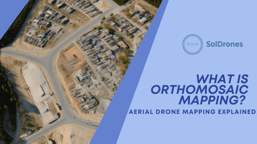
Understanding Orthomosaic Maps
An orthomosaic map is a precise photo representation of an area created by stitching together overlapping aerial images using specialized photogrammetry software. Orthoimages are combined and geometrically corrected to align the scale, allowing true measurement of distances, often adjusting for topographic relief, lens distortion, and camera tilt.
This uniformity of scale and accuracy of distances is what makes orthomosaic maps so valuable. Unlike normal aerial photos or perspective views seen on platforms like Google Maps or Google Earth, orthomosaic maps are free from lens distortion and topographic relief, providing users with a true-to-scale map-quality image.
The creation of these detailed maps involves capturing smaller images called orthoimages or orthophotos, which are corrected for distortions caused by camera lenses and drone position during flight.
The Process Behind Orthomosaics:
The process behind creating orthomosaic maps is typically as follows:
- Data Collection: High-resolution cameras on a drone capture multiple overlapping aerial photographs of the target area.
- Digital Processing: Advanced drone mapping software like Pix4Dmapper or Agisoft Metashape processes the captured images to remove any distortions.
- Mosaicking: The corrected orthophotos are stitched together into one cohesive mosaic map while maintaining their original geospatial accuracy.
- Analyzing & Sharing: Users can analyze data within their preferred Geographic Information System (GIS) software or share the final orthomosaic map with others for further collaboration.
While aerial photography is often a form of art, orthomosaic mapping is very scientific.
The Science of Orthomosaic
The scientific process of creating orthomosaics is typically data collection, digital processing, mosaicking, and analyzing. In many cases, drones collect the data, or aerial photos, capturing a series of overlapping aerial photographs of a designated area. Post-collection, these images undergo a digital processing phase using specialized photogrammetry software. This software corrects any distortions induced by the drone’s position or camera lenses during the flight, ensuring each image is orthorectified.
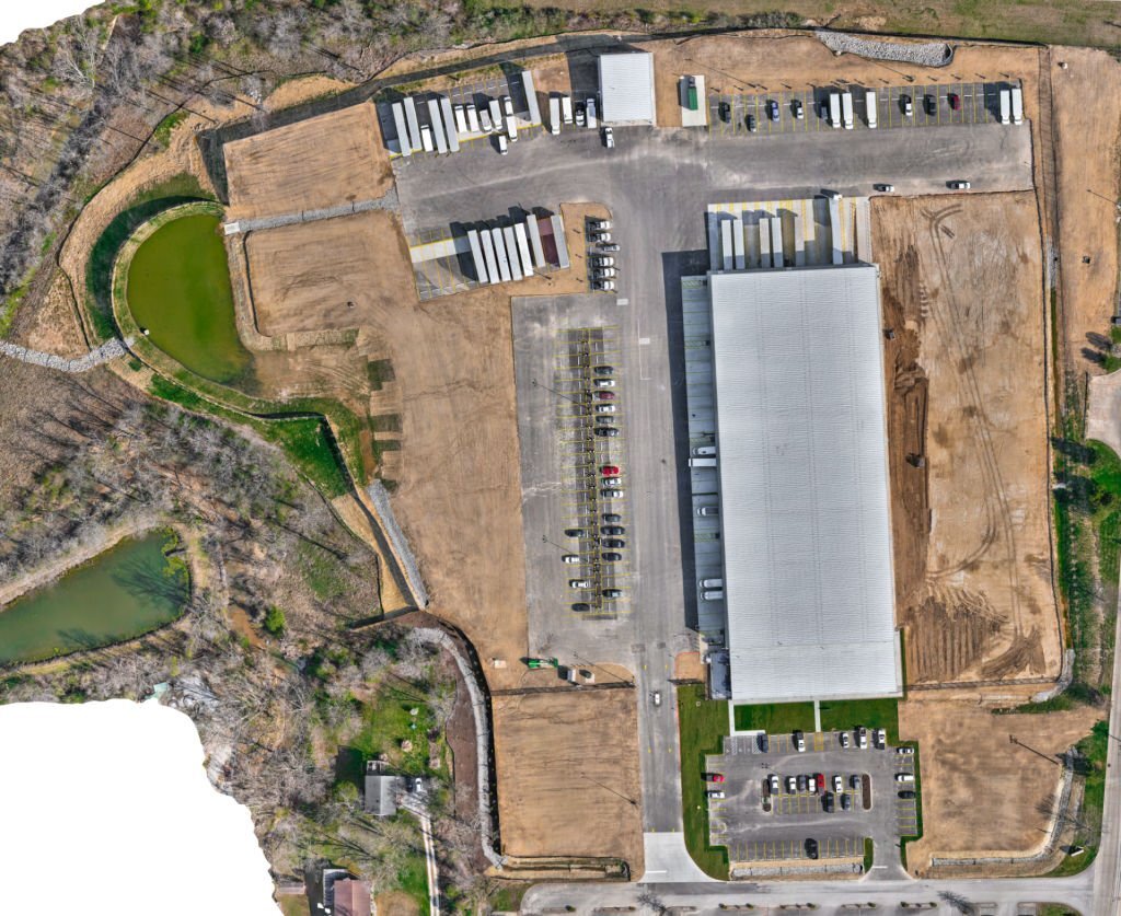
The orthorectified images, or orthophotos, are then merged to create a single, large map—an orthomosaic—while maintaining the original geospatial accuracy. The result is a meticulous and accurate representation of the Earth’s surface, ideal for multiple applications ranging from emergency response to construction, agriculture, environmental conservation, and urban planning.
The Importance of Flight Planning in Aerial Mapping
As with any scientific process, much of the success depends upon the preparation. The crucial role of a well-executed flight plan in orthomosaic mapping becomes apparent when creating orthomosaic maps.
A flight plan is a predetermined strategy for drone navigation that outlines the drone’s path, capturing intervals, and key points of interest. It ensures efficient, comprehensive data collection, contributing to the creation of accurate, high-quality orthomosaic maps.
Consider a project undertaken without a comprehensive flight plan. The drone, launched without a predefined path, captures images haphazardly, often missing critical areas or capturing redundant or irrelevant views. This lack of systematic data collection can lead to significant gaps in the final orthomosaic map, degrading its quality and rendering it inadequate for precise assessments or informed decision-making.
Conversely, consider a project executed with a meticulous flight plan. In this instance, the drone follows a predetermined path, capturing high-resolution imagery at regular intervals with adequate overlap. Every image collected is relevant and contributes meaningfully to the overall project, providing a comprehensive and accurate view of the terrain. This precise data collection ensures a high-quality, detailed orthomosaic map, offering actionable insights that can drive more informed decision-making processes, thus reinforcing the strategic value of a well-crafted flight plan in orthomosaic mapping.
Top 5 Industries Utilizing Orthomosaic Maps
Navigating the vast expanse of industries that benefit from orthomosaic mapping reveals its transformative influence. From precision agriculture to infrastructure inspection, law enforcement to real estate, the widespread utility of this technology is evident in its diverse applications.
While many industries are embracing orthomosaic imagery, here are 5 industries that are at the forefront of adoption.
- Law Enforcement Agencies: Orthomosaic maps have proven instrumental in facilitating efficient emergency responses by law enforcement agencies. For instance, in search and rescue operations, these detailed maps enable rapid scanning of large and challenging terrains, increasing the likelihood of a successful operation. Similarly, they have been used to coordinate responses to natural disasters, such as the mapping of flood-hit areas during Hurricane Harvey to aid in effective evacuation and relief work.
- Real Estate: Orthomosaic maps offer real estate professionals an innovative means to showcase properties, especially sprawling estates. For example, in marketing luxury estates in Florida, orthomosaic maps provide an interactive, detailed overview of the property, allowing potential buyers to get a comprehensive understanding of the property’s scope, location, and nearby amenities.
- Construction: Orthomosaic mapping has markedly transformed the construction sector. These maps offer a detailed, up-to-date overview of construction sites, enabling project managers to accurately monitor progress, plan logistics, and make informed, data-driven decisions. For instance, the construction of the San Francisco 49ers’ Levi’s Stadium utilized drone technology and orthomosaic mapping for tracking progress and detecting potential issues early on.
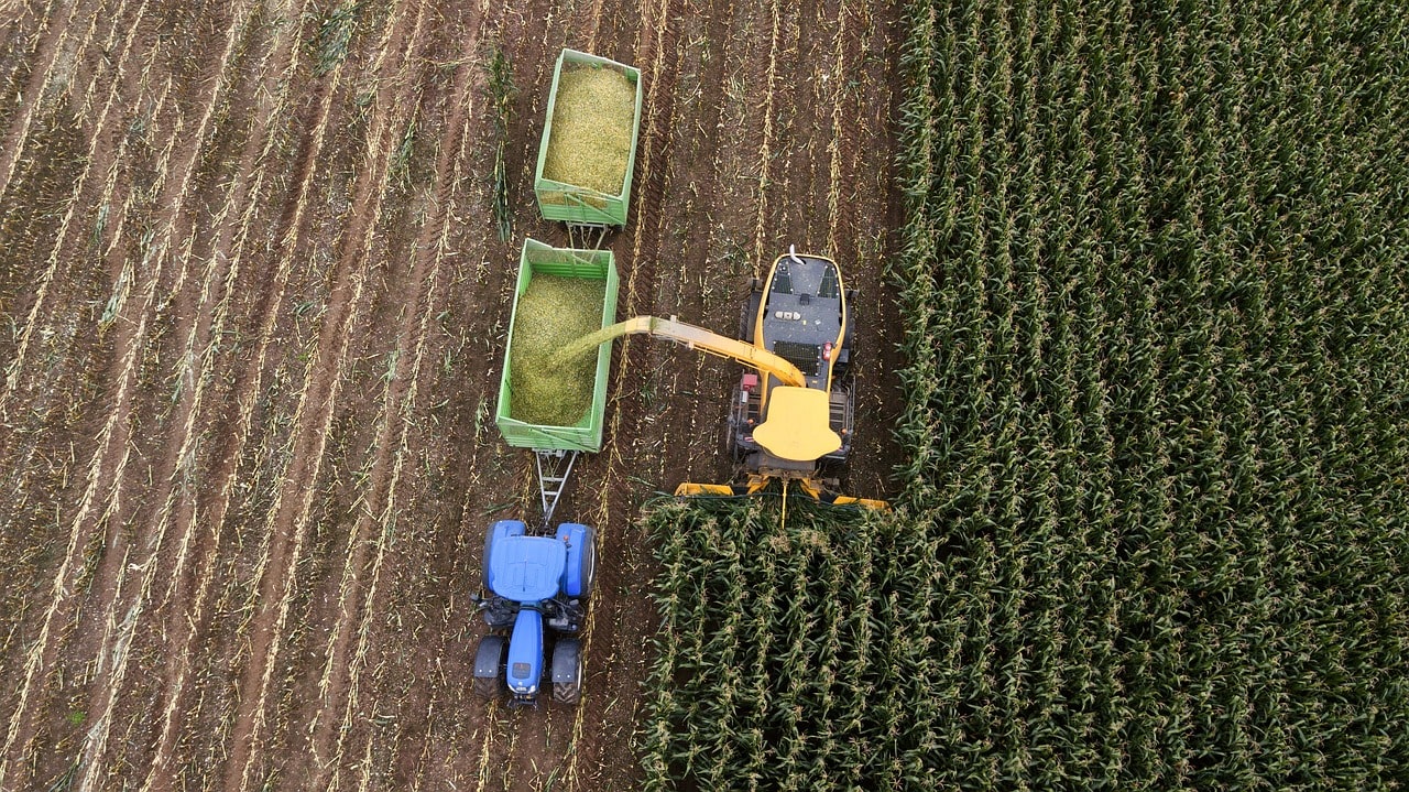
- Agriculture: In agriculture, orthomosaic maps play an integral role in resource management. They provide detailed insights into crop health, soil conditions, and irrigation needs, allowing farmers to optimize their resources and boost productivity. Precision agriculture practices, such as those employed by vineyards in California’s Napa Valley, use these maps to monitor vine health, moisture levels, and pest infestation, leading to improved yield and quality.
- Aerial Inspections: Infrastructure industries, particularly those dealing with large equipment such as power lines, wind turbines, or pipelines, have adopted orthomosaic maps to streamline their inspection processes. They provide detailed aerial views of facilities, making it easier and safer to detect issues and plan maintenance. For example, power companies like Duke Energy have used these techniques to inspect their vast network of power lines, improving safety and efficiency.
Orthomosaic mapping has proven invaluable in enhancing decision-making processes while improving overall efficiency and safety standards in various industries.
Best Drones for Orthomosaic Map Creation
Drone technology has revolutionized the creation of orthomosaic maps, making them faster and more accurate.
- DJI Phantom 4 RTK: The DJI Phantom 4 RTK ensures centimeter-level accuracy when capturing aerial images for orthomosaic mapping projects. This is a compact drone that’s perfect for low-altitude mapping.
- eBee X: The eBee X can cover up to 500 hectares (1,235 acres) in a single flight, making it ideal for creating detailed ortho maps of vast areas. It’s also a lightweight drone equipped with 3D, RGB, multispectral, and thermal cameras.
- Autel Robotics EVO Lite+: The Autel Robotics EVO Lite+ drone can capture high-resolution images and has a 1-inch CMOS sensor, making it suitable for creating detailed orthomosaic maps.
- Delari UX11: Delair UX11 can cover large distances while maintaining high-quality image capture, making it an excellent option for generating accurate orthomosaic maps. It’s very easy to use and has a high data-quality output.
Using these drones in aerial mapping projects enhances decision-making processes, monitors progress over time, and improves overall project efficiency.
Software Solutions for Generating Orthomosaics
Creating detailed orthomosaic maps from drone-captured imagery requires specialized software programs like Pix4Dmapper, Agisoft Metashape, and DroneDeploy’s Mapping Software Platform.
- Pix4Dmapper: Pix4DMapper is a robust photogrammetry solution that offers powerful processing options and versatile outputs for creating high-quality orthomosaic maps.
- Agisoft Metashape: Agisoft Metashape is another popular option among professionals seeking advanced photogrammetry tools to create precise ortho maps. It’s fast and accurate and capable of processing digital images to generate 3D spatial data.
- DroneDeploy: DroneDeploy’s Mapping Software Platform delivers user-friendly mapping solutions that cater to both beginners and experienced users. DroneDeploy is an industry leader and is used by thousands of companies to help with scaling drone mapping operations.
These software solutions, when used with high-quality drones, can generate accurate and detailed orthomosaic maps for various applications, from law enforcement operations to real estate marketing.
It’s essential for businesses across multiple sectors to stay informed about the latest developments in aerial mapping software and capitalize on the benefits they offer.
Benefits of Orthomosaic Maps in Aerial Mapping
By this point, you have a solid understanding of why orthomosaic mapping is important, how it can be done, and the equipment needed to create orthomosaic maps. A few other major benefits of orthomosaic maps are as follows:
- Precise Measurements: Orthophotos provide accurate distance, area, and volume calculations for effective resource management in construction and agriculture.
- Comprehensive Aerial View: Orthomosaics offer an undistorted view of the landscape, providing a better understanding of terrain features without perspective distortions, making them ideal for court cases involving property disputes or environmental assessments.
- Project Monitoring Efficiency: Orthomosaic mapping offers efficient project monitoring in agriculture, construction, and environmental sectors by enabling tracking of changes over time, enhancing crop health assessment, progress tracking, and informed decision-making for habitat preservation or urban planning.
Orthomosaic mapping, with its capacity for precise measurements and comprehensive aerial views, supports industries like agriculture, construction, and environmental monitoring by providing accurate distance, area, and volume calculations and an undistorted view of the landscape. This enhanced visibility promotes efficiency in project monitoring and facilitates informed decision-making, driving superior outcomes across various sectors.
Unraveling the Future of Orthomosaic Mapping
The future of orthomosaic mapping looks promising, with several emerging trends paving the way for further innovation. Autonomous drones, artificial intelligence, and machine learning are making their way into the orthomosaic mapping process. The integration of these technologies is expected to enhance the speed and accuracy of data collection and processing.
For instance, autonomous drones equipped with AI can be programmed to follow optimized flight paths and capture images at precise intervals. On the other hand, machine learning algorithms can help identify patterns and insights from orthomosaic maps, such as detecting changes in vegetation health over time in agricultural fields.
Furthermore, real-time orthomosaic mapping is on the horizon, which can drastically enhance decision-making processes in time-critical situations, such as disaster management or emergency response.
Final Thoughts
Orthomosaic maps, achieved by stitching together geometrically corrected aerial images, provide precise, uniform, and accurate representations of a landscape. This meticulous process involves careful data collection with drones, digital processing, mosaicking, and analysis, with a well-planned flight path significantly impacting the quality of the final output. These maps find widespread application across diverse industries, from law enforcement to agriculture, with specialized drones and software facilitating their creation. The future of orthomosaic mapping, encompassing the integration of autonomous drones and artificial intelligence, holds great promise, continually revolutionizing decision-making and efficiency across various sectors.
FAQs
What is an orthomosaic map?
An orthomosaic map is a detailed and accurate photo representation of an area, created by stitching together geometrically corrected, overlapping aerial images. These images are captured by drones and processed using specialized photogrammetry software to remove distortions and provide a true-to-scale map-quality image.
How are orthomosaic maps created?
The creation of orthomosaic maps involves a process called orthorectification, which includes data collection, digital processing, mosaicking, and analysis. High-resolution cameras on drones capture multiple overlapping aerial images, which are then digitally processed to remove distortions. The corrected images, known as orthophotos, are stitched together into a comprehensive map that maintains its original geospatial accuracy.
Why is flight planning important in the creation of orthomosaic maps?
Flight planning, which involves outlining a predetermined strategy for drone navigation, ensures efficient and comprehensive data collection, contributing to the creation of high-quality orthomosaic maps. Without a proper flight plan, data collection might be haphazard, resulting in gaps or redundancies in the final orthomosaic map.
What industries can benefit from orthomosaic maps?
Many industries can benefit from orthomosaic maps, including law enforcement, real estate, construction, agriculture, and infrastructure. For example, these maps can help law enforcement agencies coordinate responses to natural disasters, assist real estate professionals in showcasing properties, enable project managers to monitor construction progress, provide farmers with insights into crop health, and streamline infrastructure inspection processes.
What does the future hold for orthomosaic mapping?
The future of orthomosaic mapping is promising, with advancements in autonomous drones, artificial intelligence, and machine learning expected to enhance the speed and accuracy of data collection and processing. For instance, autonomous drones equipped with AI can be programmed to follow optimized flight paths and capture images at precise intervals. Furthermore, real-time orthomosaic mapping, which can drastically enhance decision-making processes in time-critical situations, is on the horizon.