
The usage of drones in aerial surveying and mapping has created a seismic shift in the field. Take, for instance, the work of Aerotas, a company that has been leveraging drone technology to deliver high-precision survey data for land surveyors and civil engineers across the United States.
The Technology Behind Drone Surveying and Mapping
At the core of drone surveying and mapping, there are three primary components: sensors, high-resolution cameras, and GPS. Each drone flight is a meticulous mission of data capture, with the drones’ sensors and cameras harvesting raw information with high accuracy across vast swaths of land.
This raw data is then fed into the process of photogrammetry, a sophisticated technique of converting two-dimensional images into three-dimensional models.
Ultimately, the result is a detailed and precise representation of the landscape – a testament to the revolutionary role of drone technology in modern surveying and mapping endeavors.
Benefits of Using Drones for Aerial Surveying and Mapping
The advantages of drone technology in aerial surveying and mapping are manifold: precision, efficiency, safety, and cost-effectiveness all count among the most prominent benefits.
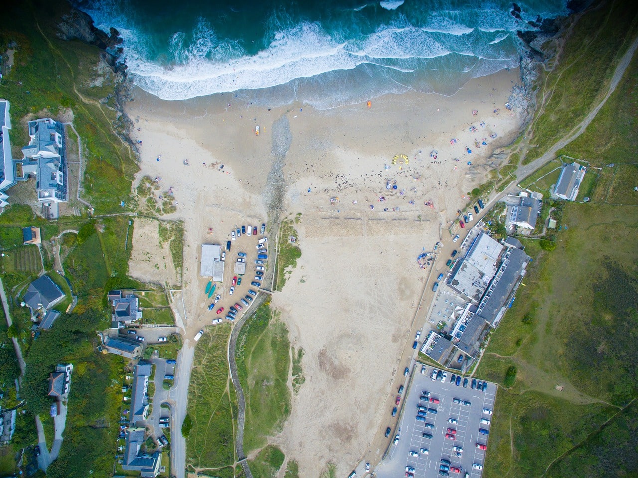
Drones excel under diverse environmental conditions, capturing data from different angles to create high-resolution orthomosaics, thus providing a highly detailed perspective of the area under study.
In contrast, traditional surveying methods often involved significant labor, cost, and time, with results being less detailed and more susceptible to human error.
Drone technology effectively addresses these issues, providing the detailed data necessary for making important decisions.
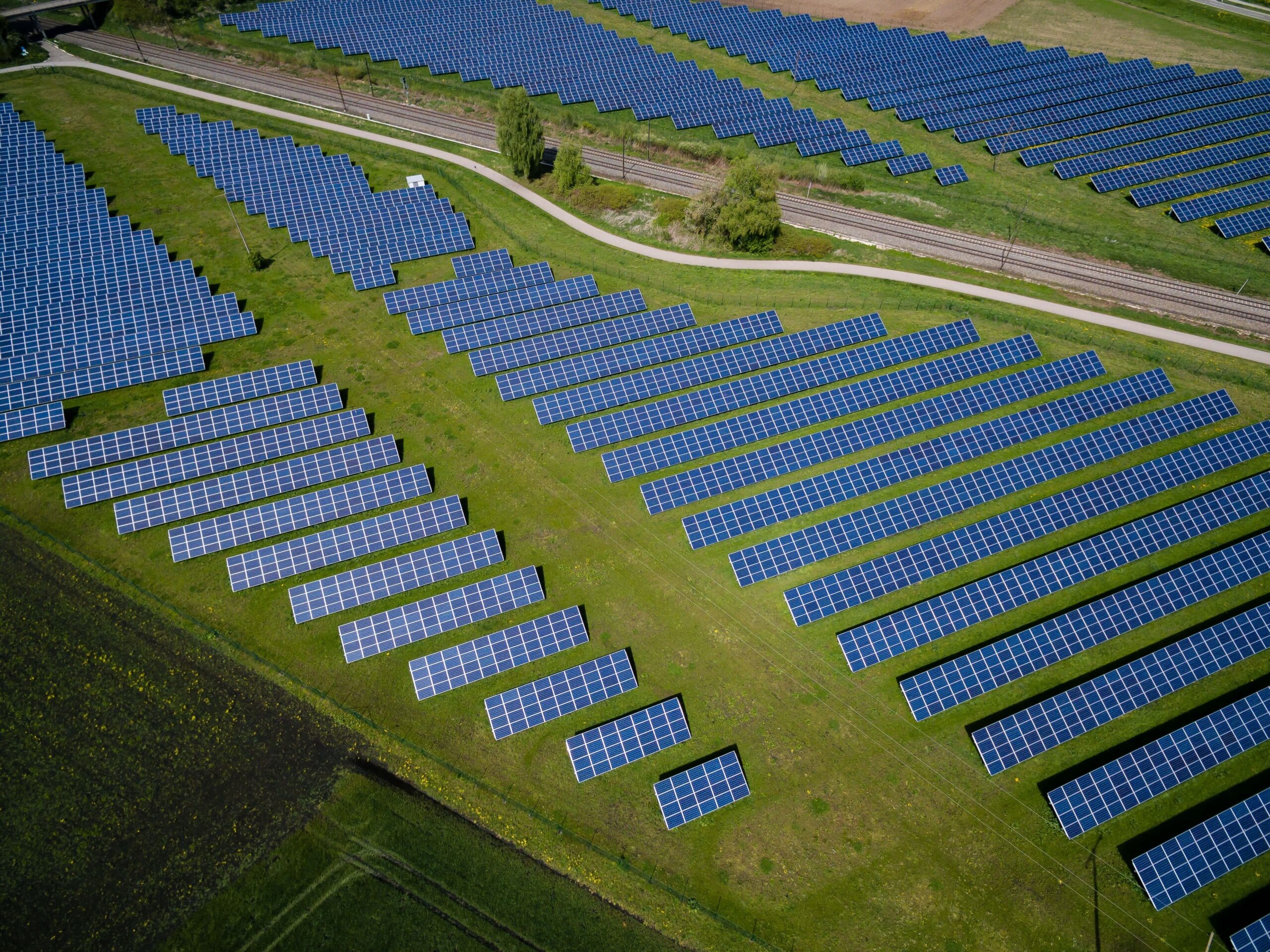
Consider the solar industry, where a case study showcases the game-changing nature of drone surveying. For large solar farms, drones equipped with thermal imaging cameras and GPS are used to create comprehensive maps of the installation.
These maps can pinpoint inefficiencies or damage, saving time and money in the maintenance and optimization of these vast arrays of solar panels.
Aerial Surveying and Mapping Techniques
The execution of aerial surveying and mapping techniques with drones involves a meticulous process that commences once the drone ascends.
Its sensors and cameras begin to capture data from different angles, a capability enhanced by the drone’s maneuverability and ability to navigate various environmental conditions.
Whether it’s a standard camera for visual data or Light Detection and Ranging (LiDAR) for topographical data, the drone effectively records raw information as it flies over the area of interest.
The ability to survey vast landscapes or intricate urban settings swiftly and accurately is a testament to the remarkable precision of this technology.
After landing, the post-flight phase begins.
The raw data collected during the flight is processed using advanced drone mapping software, transforming it into high-resolution orthomosaics, 3D models, and Digital Surface Models (DSMs).
This valuable information can influence important decisions in industries ranging from urban planning to environmental conservation, such as the case study of solar farms optimizing panel placement based on drone data.
Drone Mapping Software
In general, aerial surveying and mapping cannot be done without using a drone mapping software program.
As the hub where captured data from the aerial camera gets processed, the drone mapping software not only generates high-resolution orthomosaics but also develops complex digital elevation models.
Through the power of algorithms, it seamlessly stitches together images, transforming them into an accurate and comprehensive aerial survey.
GIS professionals heavily rely on this software to make sense of the raw data collected by drones, using it to create models that serve as an essential foundation for further analysis.
In essence, drone mapping software offers a time-efficient means to convert data into actionable insights, thereby serving as an indispensable tool in the field of aerial surveying and mapping.
For example, Pix4Dmapper, one of the leading photogrammetry solutions available today enables users to transform raw images captured during a drone survey into geo-referenced maps or 3D models easily. Another commonly used aerial mapping software is DroneDeploy.
Applications of Aerial Surveying and Mapping with Drones
The applications of aerial surveying and mapping with drones have significantly disrupted various industries. From agriculture to construction, environmental studies, and more, these unmanned aerial vehicles have proven indispensable.
Drones offer unparalleled capabilities in collecting accurate aerial data, facilitating informed decision-making, enhancing safety, and boosting efficiency.
Construction
In the construction industry, drones are becoming key to monitoring construction sites. Traditional methods can be labor-intensive, while drone surveying provides absolute accuracy, essential for project planning and mitigating potential issues.
Aerial images and drone imagery captured by drones are used to create orthomosaics and digital elevation models, aiding in visualizing the site in real time.
Agriculture
Agriculture is another sector that has witnessed a significant transformation due to aerial surveying and mapping with drones. The drone flies over vast fields, equipped with an RGB camera, collecting aerial data and creating thermal maps to assess crop health.
This information aids farmers in making important decisions, leading to improved crop yields and sustainable farming.
Disaster Management
In disaster management, the use of drone surveying is invaluable. Drones can swiftly conduct an aerial survey of the affected areas, providing real-time data to assist in rescue efforts and damage assessment.
The drone imagery, coupled with thermal maps, can identify hotspots or areas needing immediate attention.
Environmental Studies
Environmental studies and climate change monitoring benefit greatly from aerial surveying and mapping. Drones capture data over diverse environmental conditions, including inaccessible regions.
The information gathered contributes significantly to studies on forest changes, pollution levels, and glacier movements, propelling essential climate change research.
Infrastructure
Drones have proven to be instrumental in infrastructure maintenance and inspections.
With their ability to reach challenging and risky places, drones provide high-resolution orthomosaics that aid in assessing the health of structures like power lines, bridges, and towers. The level of accuracy offered by these aerial surveys surpasses traditional methods.
Wildlife Monitoring
Lastly, wildlife monitoring and conservation have embraced drone surveying. Drones can cover large territories, allowing for efficient tracking of endangered species and habitat changes. Drone surveys, offering minimal disturbance to wildlife, have proven to be a game-changer in this field.
These are just several of the industries positively impacted by aerial surveying and mapping with drones.
Over time, drones will undoubtedly become adopted across almost all sectors, given the clear applications to improve with data measurements, save time, capture high-resolution images, and more.
Final Thoughts
Aerial surveying and mapping with drones is not only revolutionizing the geospatial landscape but also accelerating progress across a wide range of industries.
From construction and agriculture to wildlife conservation and climate change studies, the superior accuracy, efficiency, and cost-effectiveness of drones far outstrip conventional methodologies.
By effectively converting raw aerial data into actionable intelligence through drone mapping software, professionals are equipped to make more informed and strategic decisions. As technology continues to advance, the potential of drones in aerial surveying and mapping will undoubtedly continue to expand, ushering in new possibilities for the future.
FAQs
What is aerial surveying and mapping with drones?
Aerial surveying and mapping with drones involve the use of Unmanned Aerial Vehicles (UAVs) equipped with sophisticated cameras and sensors to collect intricate aerial imagery and topographic data. This information is then processed and interpreted by Geographic Information Systems (GIS) professionals to create highly detailed and precise representations of landscapes.
What are the benefits of using drones for aerial surveying and mapping?
Drones offer numerous advantages for aerial surveying and mapping, including precision, efficiency, safety, and cost-effectiveness. They can operate under diverse environmental conditions and capture data from different angles, creating high-resolution orthomosaics that provide a detailed perspective of the area being studied.
What is the technology behind drone surveying and mapping?
Drone surveying and mapping utilize a combination of sensors, high-resolution cameras, and GPS. The data captured by these devices during a flight is then processed using photogrammetry to convert two-dimensional images into three-dimensional models.
What are some applications of aerial surveying and mapping with drones?
Aerial surveying and mapping with drones is used in a variety of industries including construction, agriculture, disaster management, environmental studies and climate change monitoring, infrastructure maintenance and inspections, and wildlife monitoring and conservation. They provide unprecedented accuracy and efficiency in collecting and analyzing aerial data, leading to better decision-making.
What role does drone mapping software play in aerial surveying and mapping?
Drone mapping software is a critical component of aerial surveying and mapping. It processes the raw data collected from the aerial camera and generates high-resolution orthomosaics and complex digital elevation models. This allows GIS professionals to convert data into actionable insights, greatly saving time and improving efficiency.